One of the main challenges of WP3 is to cope with the specific problems inherent to across-track stereo pairs. Because the images are taken from a different orbital pass of the satellite at a different date, across-track pairs have some major restrictions. Different illumination conditions, ground surface changes and different image geometry leads to dissimilarities between the images and to mismatching during the photogrammetric processing.
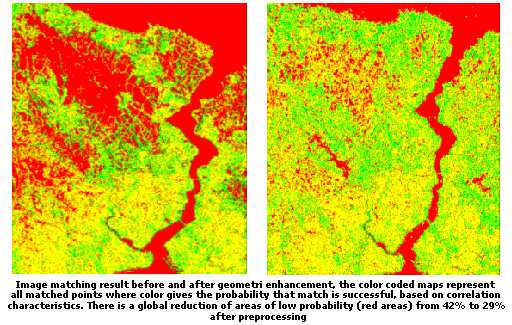
First of all, stereo are were carefully selected from the archive. Area coverage, stereo constellation, cloud-freeness and image acquisition time interval are chosen as main criteria for the selection. To reduce radiometric dissimilarities between the images, a radiometric enhancement is performed. To enhance the contrast for each image individually and to equalize the radiometric differences between the imagery, a Wallis filter is applied. The Wallis filter performs a non-linear, locally adaptive contrast enhancement, resulting in good local contrast while reducing the overall contrast between bright and dark areas.
Next to radiometric enhancement, a method for geometric normalization was devised. As the images of each across-track stereo pair are taken from different orbits, the images are displaced to each other and the internal geometry will be slightly different because of the different scan direction. A first-order polynomial transformation is performed to geometrically align the multi-temporal imagery. A first-order polynomial transformation corrects for rotation, translation, scaling and shearing.
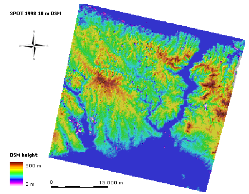
Based on a dataset of 40 ground control points homogeneously distributed over the study area, photogrammetric products are derived from the four across-track pairs with the photogrammetric software package SAT-PP.
|