| More than ever before, planners and policy makers need tools to anticipate and assess the impact of their decisions on the spatial systems that they are to manage. A growing number of high resolution dynamic land-use models is currently being developed for this purpose.
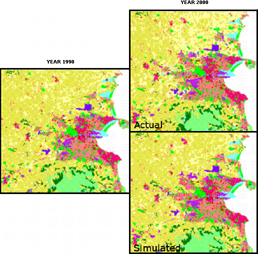
Typically the required time series of land-use maps based on identical and consistent mapping methodologies, legends and scales are missing. As a result, the differences observed in a series of land-use maps are often not real land-use changes, but mismatches that should not be compared with model predictions of land use changes.
On the other hand, earth observation satellites provide images of the earth's surface since the early seventies. Their temporal availability is relatively high compared to land-use maps and a series of remote sensing images of one sensor is consistent in time and space. However, the spatio-temporal availability and consistency heavily depend on atmospheric conditions. The main problem is that conventional remote sensing based classifications result in land-cover maps, based on physical properties of the surface, rather than land-use maps representing functional classes.
|